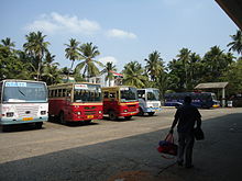
Kerala has 145,704 kilometres (90,536 mi) of roads; it accounts for 4.2% of India’s total. This translates to about 4.62 kilometres (2.87 mi) of road per thousand population, compared to an average of 2.59 kilometres (1.61 mi) in the country. Roads in Kerala include 1,524 km of national highway; it is 2.6% of the nation’s total, 4341.6 km of state highway and 18900 km of district roads.[235] Most of Kerala’s west coast is accessible through two national highways: NH 47 and NH 17, and the eastern side is accessible through various state highways.[236] There is also a hill highway proposed, to make easy access to eastern hills.[237] National Highway 17 with the longest stretch of 421 km connects Edapally to Panvel; it starts from Kochi and passes through Kozhikode, Kannur, Kanhangad, Kasaragod and Uppala before entering Karnataka.[236] District Palakkadis generally referred to as the Gateway of Kerala due to the presence of the Palakkad Gap, in the Western Ghats, which connects the Northern (Malabar) and Southern (Travancore) parts of Kerala to rest of India via road and rail. It has the state’s largest check post Walayar through which all the major public and commercial transportation happens, to reach all other districts of Kerala.[238]
The Department of Public Works is responsible for maintaining and expanding the state highways system and major district roads.[239] The Kerala State Transport Project (KSTP), which includes the GIS-based Road Information and Management Project (RIMS), is responsible for maintaining and expanding the state highways in Kerala; it also oversees a few major district roads.[240][241] Traffic in Kerala has been growing at a rate of 10–11% every year, resulting in high traffic and pressure on the roads. Road density is nearly four times the national average, reflecting the state’s high population density. Kerala’s annual total of road accidents is among the nation’s highest. The accidents are mainly the result of the narrow roads and irresponsible driving.[242] National Highways in Kerala are among the narrowest in the country and will remain so for the foreseeable future, as the state government has received an exemption that allows narrow national highways. In Kerala, highways are 45 meters wide. In other states National Highways are grade separated highways 60 meters wide with a minimum of four lanes, as well as 6 or 8 lane access-controlled expressways.[243][244] NHAI has threatened the kerala state government that it will give high priority to other states in highway development as political commitment to the better highways has been lacking from the government,[245] although State had the highest road accident rate in the country, with most fatal accidents taking place along the State’s NHs.[246]
Railways[edit]

The main Portico of theThiruvananthapuram Central Railway Station
The Indian Railways‘ Southern Railway line runs through the state connecting most of the major towns and cities except those in the highland districts of Idukki andWayanad.[247] The railway network in the state is controlled by two out of six divisions of Southern Railway; Thiruvananthapuram Railway division and Palakkad Railway Division.[248] Thiruvananthapuram Central (TVC) is the busiest railway station in the state. Kerala’s major railway stations are Thiruvananthapuram Central (TVC), Ernakulam Junction (South) (ERS), Kozhikode (CLT), Shornur Junction (SRR), Palakkad Junction (PGT), Kollam Junction (QLN), Kannur (CAN), Thrissur Railway Station (TCR),Ernakulam Town (North)(ERN) Alappuzha (ALLP), Kottayam (KTYM) Kayamkulam Junction (KYJ) and Chengannur (CNGR). Major railway transport between Beypore–Tirurbegan on 12 March 1861, from Shoranur–Cochin Harbour section in 1902, from Shenkottai–Punalur on 26 November 1904, from Nilambur–Shoranur in 1927, fromPunalur–Thiruvananthapuramon 4 November 1931, from Ernakulam–Kottayam in 1956, from Kottayam–Kollam in 1958, from Thiruvananthapuram–Kanyakumari in 1979 and from Thrissur-Guruvayur Section in 1994.[249]
Airports[edit]
Kerala has three international airports; Trivandrum International Airport, Cochin International Airport and Calicut International Airport. One international airport is proposed, atKannur.[250] Officials say that the Kannur International Airport will be completed in December 2015. [251][252] Kollam Airport was the first airport of Kerala during the Madras Presidency government, which had been closed before the inauguration of the airport in the capital city of Kerala.[253] Trivandrum International Airport, is one among the oldest existing airport in South India, managed by the Airport Authority of India while Cochin International Airport is the busiest in the state and 7th busiest Airport in the country. It was the first Indian airport to be incorporated as a public limited company; it was funded by nearly 10,000 non-resident Indians from 30 countries. Cochin Airport is the primary hub of Air India Express and the secondary hub of Air Asia India[254]
Inland water transport[edit]

Junkar Service Fort Kochi
Kerala has numerous backwaters, which are used for commercial inland navigation. Transport services are mainly provided by country craft and passenger vessels.[205] There are 67 navigable rivers in the state while the total length of inland waterways is 1,687 kilometres (1,048 mi).[255] The main constraints to the expansion of inland navigation are lack of depth in waterways caused by silting, lack of maintenance of navigation systems and bank protection, accelerated growth of the water hyacinth, lack of modern inland craft terminals, and lack of a cargo handling system.[205] A 205 kilometres (127 mi) long canal, National Waterway 3, runs between Kottapuram and Kollam.[256]
Demographics[edit]

| [show]Population trend |
|---|
Kerala is home to 2.76% of India’s population; at 859 persons per km2, its land is nearly three times as densely settled as the rest of India, which is at a population density of 370 persons per km2.[261] As of 2011, Thiruvananthapuram is the most populous city in Kerala.[262] In the state, the rate of population growth is India’s lowest, and the decadal growth of 4.9% in 2011 is less than one third of the all-India average of 17.64%.[261] Kerala’s population more than doubled between 1951 and 1991 by adding 15.6 million people to reach 29.1 million residents in 1991; the population stood at 33.3 million by 2011.[261] Kerala’s coastal regions are the most densely settled with population density of coastal districts being 2022 persons per km2, 2.5 times the overall population density of the state, 859 persons per km2, leaving the eastern hills and mountains comparatively sparsely populated.[263] Around 31.8 million Keralites are predominantly Malayali.[264] State’s 321,000 indigenous tribal Adivasis, 1.10% of the population, are concentrated in the east.[265]:10–12 Malayalam, one of the classical languages in India, is Kerala’s official language.[266] Tamil, Kannada, Tulu, Hindi, Bengali, Mahl and various Adivasi (tribal) languages are also spoken.[267][268][269][270][271] As of early 2013, there are close to 2.5 million (7.5% of the state population) migrant labourers in Kerala from other parts of India.[272]
| [hide]List of Major cities in Kerala | |||||||||
|---|---|---|---|---|---|---|---|---|---|
| No. | City | District | Population |  Thiruvananthapuram Kochi  |
 |
||||
| 1 | Thiruvananthapuram | Thiruvananthapuram | 796,084 | ||||||
| 2 | Kochi | Ernakulam | 632,997 | ||||||
| 3 | Kozhikode | Kozhikode | 550,921 | ||||||
| 4 | Kollam | Kollam | 367,477 | ||||||
| 5 | Thrissur | Thrissur | 315,596 | ||||||
| 6 | Kannur | Kannur | 241,072 | ||||||
| 7 | Malappuram | Malappuram | 101,334 | ||||||
| Source: 2011 Census of India [262] | |||||||||
| List of major cities in Kerala as per Ministry of Urban Development publication, 2011. | |||||||||

- Nature-Inspired Living: Eco-Friendly Home Designs in Kerala - April 25, 2024
- Fashionably Green: Kerala’s Eco-Chic Home Designs for Today’s Lifestyle - April 24, 2024
- Dreams Made Eco: Kerala’s Sustainable Dream Homes - April 24, 2024